Geography · Matching and colouring worksheet
Countries and Capitals of Europe: Free KS2 Geography Worksheet
This free printable worksheet helps children in Years 5 and 6 build their locational knowledge of Europe. They first match four major countries to their capital cities using a supportive word bank, then colour a simple outline map of the continent. It prints neatly onto a single A4 page.
The activity works well as a quick starter, a homework task or a revision sheet. The matching task focuses on four widely-taught country–capital pairs, while the colouring map gives children a chance to slow down, notice borders and coastlines, and begin to picture where these places sit in relation to the United Kingdom.

Countries and Capitals of Europe
Free Geography worksheet · Ages 9 to 11
Match the country to its capital city
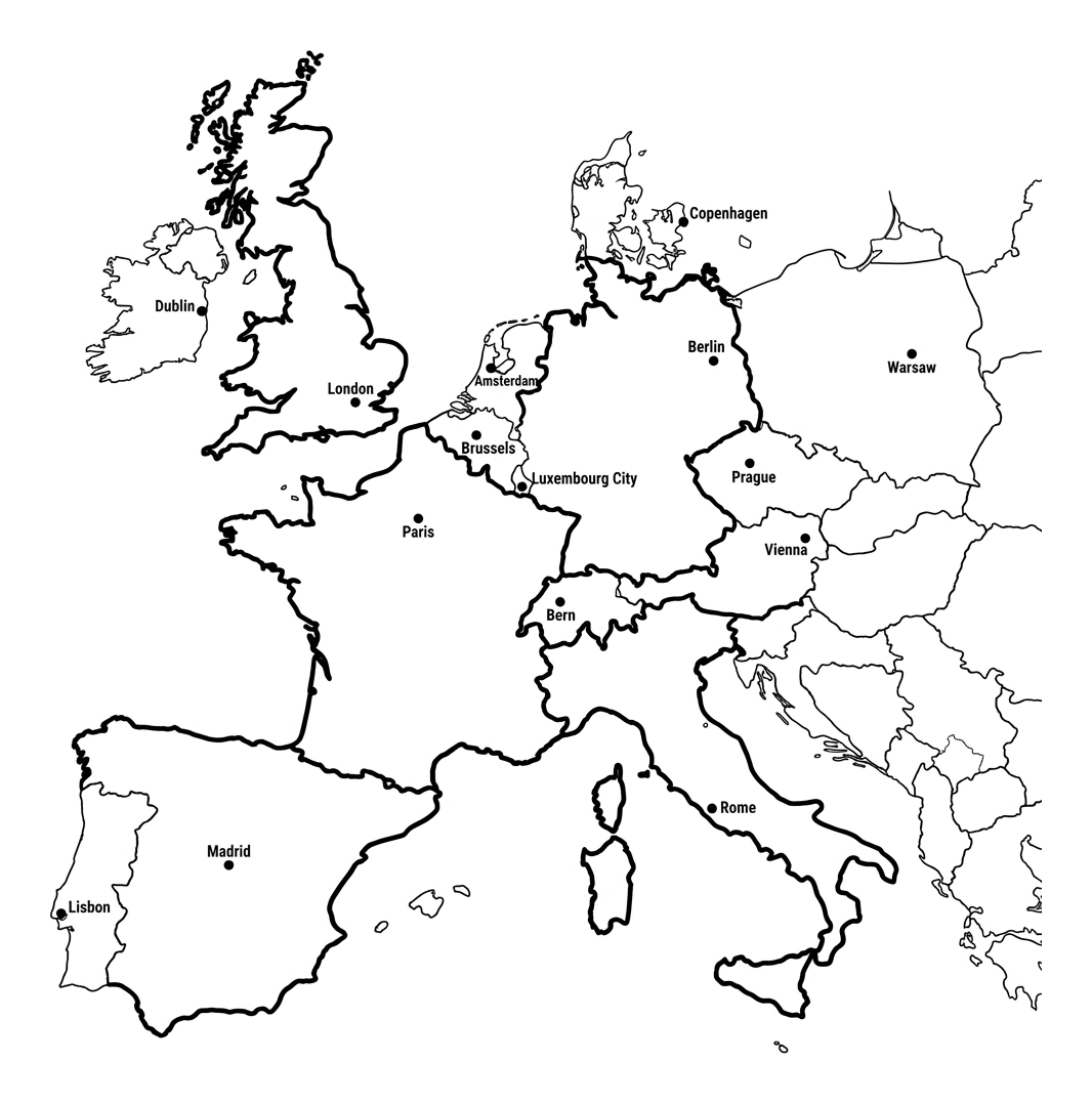
Write the correct capital city next to each country. Use the word bank to help you.
France
Spain
Italy
Germany
Colour the map of Europe
Colour each country a different colour and try to stay inside the borders. Look for the small dot in each country – it shows where the capital city is.
- Colour France one colour and find the dot for Paris.
- Colour Spain a different colour and find the dot for Madrid.
- Colour Italy a different colour and find the dot for Rome.
- Colour Germany a different colour and find the dot for Berlin.
Answer key
- France — Paris
- Spain — Madrid
- Italy — Rome
- Germany — Berlin
What this worksheet covers
The sheet introduces four of Europe's most frequently taught country–capital pairings: France and Paris, Spain and Madrid, Italy and Rome, and Germany and Berlin. These are deliberately chosen as confident, well-known starting points for upper KS2 children who are extending their place knowledge beyond the United Kingdom. A word bank lists the four capitals, so the task tests recall and reasoning rather than spelling, and children can write each capital next to the correct country. The accompanying outline map then asks children to colour the same countries (plus a few neighbours), which links the abstract names to real positions on the continent. Together the two tasks move learning from a list of facts towards a genuine mental map of Europe.
How to use it at home or in the classroom
At school, the matching task makes a tidy ten-minute starter or a low-stakes assessment of prior learning before a wider unit on Europe. Pair it with a class atlas or wall map so children can check their answers and self-correct. At home, parents and carers can turn it into a conversation: which of these cities have you heard of, and why? Has anyone in the family been to one of them? For the colouring map, suggest a different colour for each country and encourage children to keep within the borders — a small task that quietly reinforces the idea that countries are separate, bordered areas. Children who finish quickly can be challenged to add the United Kingdom's capital, London, or to name an extra country they can see on the map.
Building locational knowledge in KS2
By Years 5 and 6, the National Curriculum expects children to locate the world's countries with a focus on Europe, including the location of Russia, and to identify environmental regions, key physical and human characteristics, countries and major cities. Worksheets like this support that aim by combining naming with placing. Research-informed practice in geography stresses that children remember locations far better when they repeatedly see and use maps, rather than memorising lists in isolation. Returning to the same simplified map of Europe across several lessons — adding new countries, rivers, seas or cities each time — helps the picture stick. This sheet is designed to be one such repeatable building block.
Extending the learning
Once children are confident with these four pairs, you can widen the challenge. Ask them to find each capital in an atlas and note which sea or river it sits near, or to order the four countries by size or by distance from the UK. The colouring map can become a knowledge organiser: label seas such as the North Sea and the Mediterranean, add the English Channel, or mark a journey from London to one of the capitals. For a cross-curricular link, children might find out one famous landmark in each capital — the Eiffel Tower in Paris or the Colosseum in Rome — bringing physical geography, history and culture together.
Frequently asked questions
What are the capital cities of France, Spain, Italy and Germany?
The capital of France is Paris, the capital of Spain is Madrid, the capital of Italy is Rome and the capital of Germany is Berlin. These four pairings are the focus of this worksheet and are commonly taught in upper KS2 Geography.
Is this worksheet free to print?
Yes. The worksheet is completely free to download and print, with no sign-up required. It is designed to fit onto a single A4 page so it is quick and economical to use at home or in the classroom.
What age and year group is this worksheet for?
It is aimed at children aged 9 to 11, which covers Years 5 and 6 in upper KS2. The four country–capital pairs and the simple map make it accessible for the whole class, while the extension ideas suit children who are ready for more challenge.
How does this worksheet link to the National Curriculum?
It supports the KS2 locational knowledge objective to use maps to focus on Europe and to learn about countries and major cities. It also practises map and atlas skills, as children place countries and capitals onto an outline map of the continent.
What is the easiest way to help my child learn European capitals?
Combine naming with placing. Use this worksheet alongside an atlas or wall map, return to the same map several times, and link each capital to something memorable, such as a famous landmark or a family connection. Repeated, low-pressure practice with a map works far better than memorising a list.
Curriculum links
- KS2 Geography – Locational knowledge: locate the world's countries, using maps to focus on Europe (including the location of Russia) and North and South America, concentrating on their environmental regions, key physical and human characteristics, countries, and major cities.
- KS2 Geography – Geographical skills and fieldwork: use maps, atlases, globes and digital/computer mapping to locate countries and describe features studied.
- KS2 Geography – Place knowledge: understand geographical similarities and differences through the study of human and physical geography of a region of the United Kingdom and a region in a European country.
- KS2 Geography – Human and physical geography: describe and understand key aspects of human geography, including types of settlement and land use, and the distribution of major cities.
Made by The Owee education team. Updated 02/06/2026. Free to print and share.
More learning, made playful
Owee turns topics like this into age-right quizzes for children aged 5 to 10, with a treehouse that grows as they learn. Three subjects are free, forever.
Get Owee free